









Bologna, September 16, 2026 – September has been rather stable so far, with some thunderstorm incursions every now and then, but for now, there seem to be no other major seasonal changes. Also because the biggest turning point has happened: goodbye sultry heat. And so now “over Emilia-Romagna the week continues under the sign of atmospheric stability, with predominantly sunny conditions and temperatures rising again, especially during the daytime hours,” says Roberto Nanni, meteorologist technician at Ampro. “Maximum values could reach 27-30°C in the plains, returning to still mild levels for mid-September. The weather picture is however set to change rapidly on Thursday, September 17.”
What changes
“From Wednesday, September 16, a North Atlantic trough sinks over Northern Italy bringing clouds, rain, and thunderstorms,” explains Daniele Ingemi, meteorologist at Meteored Italy. “On the morning of Thursday, September 17, widespread bad weather will affect Tuscany, northern Lazio, western Umbria, and the inland areas of Marche and Abruzzo, with showers and thunderstorms, locally intense, on the Tyrrhenian coasts, between Tuscany and Lazio, up to the capital area.”

Thunderstorms and temperature drop also in Emilia-Romagna
Is our region safe? Actually, no. The Atlantic-origin disturbance will also cross Emilia-Romagna, “favoring an increase in cloudiness and the return of rain and showers, also of a thunderstorm nature, locally more intense,” confirms Nanni. After the front passes, there will also be an air exchange, with a general decrease in temperatures.
Where it rains
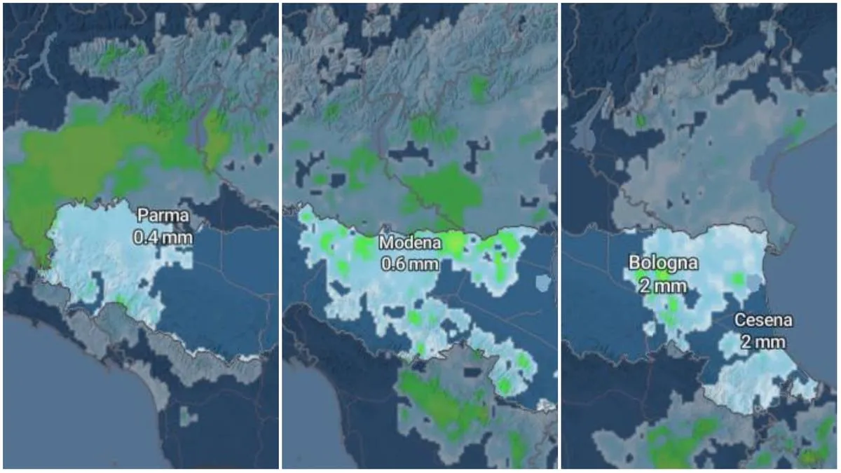
According to the Arpae weather forecasts, the new disturbance will begin to touch the west of the region – specifically the provinces of Piacenza, Parma, and the Reggio Apennines – already on Wednesday, September 16 in the evening. Then on Thursday, September 17 in the morning, thunderstorms will also extend to Modena, Bologna, and Ferrara areas.
In the afternoon, rain will cover the entire region up to the coast, which will also be affected by thunderstorms in the evening. On Thursday, September 17, minimum temperatures will slightly increase ranging between 17 and 20 degrees, with maximums decreasing, ranging between 24 and 27 degrees.
Weather alert
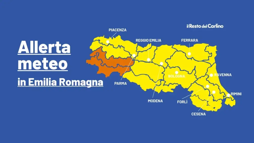
Indeed, a new weather alert for thunderstorms has been issued, valid for the entire day of September 17. Yellow alert everywhere, except between the mountain and high hill areas of Piacenza-Parma where it is orange. The Arpae bulletin states that “particularly intense and persistent thunderstorms are expected on the western reliefs, which may generate runoff phenomena and rapid rises in water levels in watercourses with possible exceedances of threshold 1. Thunderstorm phenomena during the day will move from west to east, remaining strong in intensity but with a faster evolution.”
But the weekend will be sunny
“The worsening does not seem destined to inaugurate a lasting disturbed phase,” explains Nanni. In fact, “between Friday 18 and Saturday 19 there will be conditions of variability and instability, with the possibility of further precipitation, also of a thunderstorm nature, while temperatures will remain at lower values.”
Then, “from Sunday 20 the situation will gradually improve, with the return of more clear skies and more stable conditions. However, some residual cloudiness may still cause occasional showers, especially in the central-eastern sectors of the region,” concludes the meteorologist.