


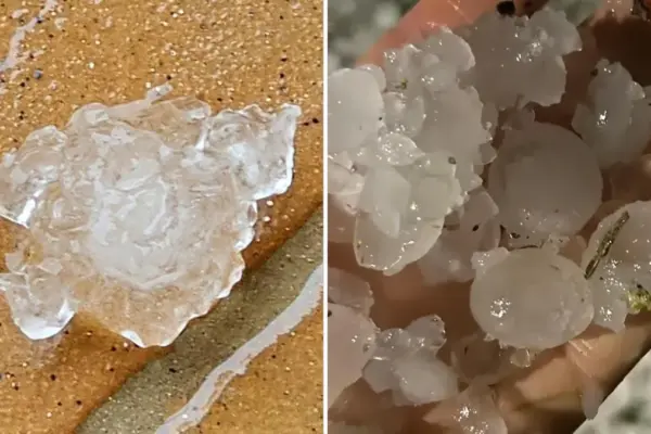
Hail and thunderstorms today, where bad weather hit in Emilia Romagna
The instability phase is however destined to gradually lose strength: the weather will improve over the weekend. But then a new worsening: here is when







The instability phase is however destined to gradually lose strength: the weather will improve over the weekend. But then a new worsening: here is when
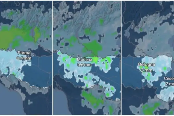
Atmospheric stability cracked by a North Atlantic break, widespread bad weather coming from the north: the map. Meteorologist Nanni: “Increase in cloudiness and the return of rain and showers, also with thunderstorms”

Goodbye unusual heat. The disturbance breaks the hegemony of the muggy weather. Analysis by Roberto Nanni (Ampro): “Expected highs of 23-26 degrees, but it’s not the end of summer.” High-intensity gusts are forecasted, associated with stormy phenomena

The heat gives way to a phase of strong instability: heavy showers and gusts of wind are coming, with greater criticality between Piacenza and Parma. Temperatures will also drop sharply, down to 23-26 degrees

After the long period of unusual heat, many locations will record significantly lower values, especially in areas directly reached by Atlantic currents. From Wednesday, September 9, the air will finally be cooler after the disturbance

Weather, yellow alert for thunderstorms on the Apennines on Wednesday. Then the African high pressure will regain control with temperatures well above average. Ampro meteorologist Nanni: “The heat will be less extreme in absolute terms, but it could remain very unusual compared to the September climatology”

A hellish evening on the coast: 30 degrees until 3:30 AM on the Riviera during the night and morning hours. Meanwhile, between Ferrara and Veneto the sea reaches 32 degrees. The highest values are in the historic centers of the region, particularly in Bologna

The double face of summer. Rain and a new heat wave in Emilia, where there is an influx of scorching air coming directly from North Africa, affecting the entire Emilia-Romagna. September will start with clouds and values above normal.

Peak days and temperatures that will remain above average even in early September. Meteorologist Randi, president of Ampro: “It could be the hottest summer since 2003. Early harvest”. Arpae forecasts for Thursday, August 27 and Friday, August 28

Tuesday, August 25 risk of intense phenomena especially on the Apennines, then a new rise in temperatures from Wednesday, August 26. Nanni: “Possible precipitation over the weekend”