









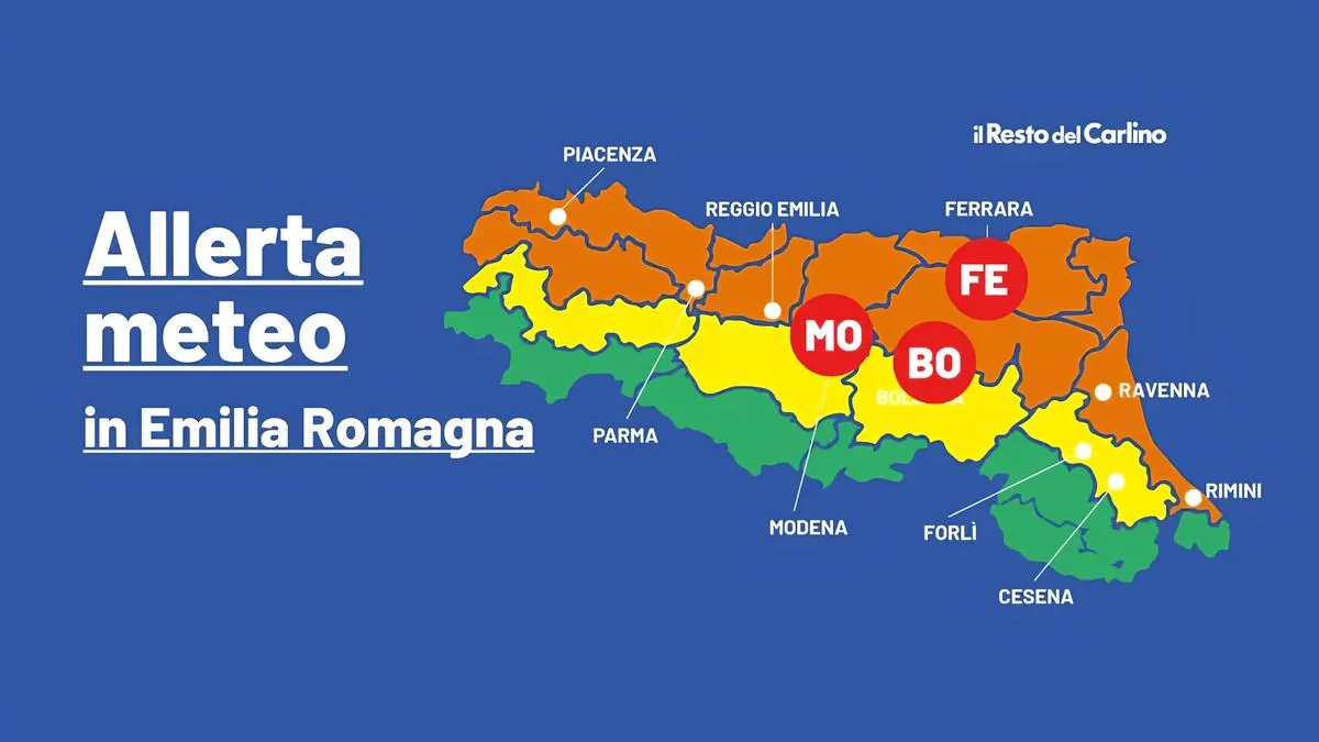
Bologna, July 28, 2026 – Heat is the protagonist of the coming days in Emilia-Romagna, with Arpae reporting high heat risk levels in several areas of the region on the days of tomorrow and the day after, July 29 and 30. The bulletin highlights the presence of red and orange alerts, with bioclimatic discomfort conditions linked to high temperatures and high humidity levels that will accompany the midweek phase. The highest level, the red alert, indicates emergency conditions with possible negative health effects even for the healthy population, while the orange alert signals significant discomfort, with particular attention to the elderly, children, and vulnerable people.
Red and orange alerts: where and when
The red alert concerns only the day of Thursday for the cities of Modena, Ferrara, and Bologna (orange for Piacenza, Parma, Reggio Emilia, and Ravenna); while the orange level concerns all of Emilia for the day of tomorrow, Wednesday (Piacenza, Parma, Reggio Emilia, Modena, Bologna, and Ferrara). The situation will be more critical in the plains and main urban centers, where heat will tend to accumulate more.
Forecast for Wednesday, July 29
The weather will remain largely stable over the region, with clear or slightly cloudy skies for most of the day. In the afternoon, however, cumulus clouds are not excluded along the Apennine hills of Emilia, where brief and local thunderstorms may develop.
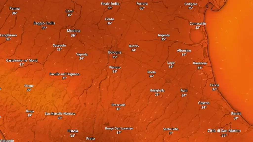
The minimum temperatures will slightly decrease, generally ranging between 19 and 22 degrees, while the maximum temperatures will rise slightly again: about 30 degrees expected along the coast and peaks between 33 and 36 degrees in the inland areas, especially in the plains. Winds will be weak from the eastern quadrants, while the sea will be slightly rough.
What the weather will be like on Thursday, July 30
Thursday will be characterized by even more stable conditions, with predominantly clear skies and no significant phenomena. The anticyclone will continue to maintain a dry and sunny weather situation, favoring a new increase in temperature values. The minimum temperatures will rise slightly and will range between 20 and 23 degrees, while during the day the heat will be felt again with maximum temperatures between 32 degrees on the coastal strip and 34-36 degrees in the inland plains. Locally, peaks up to 37 degrees are not excluded in areas farther from the sea. Winds will be weak and variable, with calm or slightly rough seas.
A late July still marked by heat
The trend for the end of the month remains that of a full summer phase, characterized by atmospheric stability and temperatures above the period average. The combination of persistent heat and humidity will continue to make the days spent especially in urban areas and plains heavy, where air exchange is more limited. Expert indications advise paying attention during the hottest hours, avoiding prolonged sun exposure and maintaining proper hydration. Heat risk monitoring will continue in the coming days through daily updates from Arpae, which take into account the expected conditions in the different areas of the regional territory.


