








Bologna, July 15, 2026 – Orange alert for a strong disturbance today in Emilia-Romagna. The weather channels monitoring today’s phenomena warn that there is a risk of intense events.
“The worsening will be very fast, just over 4 hours, but according to several weather models it could be violent,” writes Emilia-Romagna meteo. “We have stored a lot of heat and high humidity levels, so a lot of energy for thunderstorms. It all starts between France, Valle d’Aosta and upper Piedmont with the formation of thunderstorms that will then move towards the Piacenza area after 4 pm.
Times of the disturbance
Downpours are expected across Emilia-Romagna moving from west to east. Here are the times forecasted by Emilia Romagna meteo: Piacenza /Parma at 4/6 pm; Reggio Emilia/Modena 5/8 pm; Bologna /Ferrara 6/8 pm; Ravenna / Forlì 7/9 pm; Cesena/Rimini 7/10 pm.
Violent wind
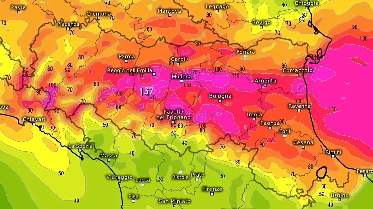
There is a possibility that wind gusts will be linear and violent. “Some models, like Icon 2D, see frightening gusts from Piacenza to Modena and across the plain between Ferrara, Bologna and Medicina, less so moving towards the coast but still significant. The gusts hypothesized by some models are extreme and unlikely to occur: peaks of 160/180 km/h would be disastrous, it is unlikely such a forecast will materialize but it cannot be ignored because we are talking about often accurate models,” warns the channel.
So sudden very strong gusts are expected, over 70/110 km/h between Piacenza and Ferrara/Bologna, less elsewhere but extreme values cannot be excluded on central plains.
Hail and downpours
Thunderstorms and hail. There is a high risk between Piacenza and Parma, medium-high over the entire flat area. Very little rain expected on the upper Apennines from Reggio Emilia to Rimini, in several areas none, a few mm on hilly areas from Reggio Emilia to Romagna. On the remaining central-eastern areas accumulations are often modest: in the Ferrara area local peaks over 20/30 mm approximately.
Thermal drop
“Significant and rapid thermal drop: Piacenza and Parma could drop in a few minutes from +34/37 degrees to +20/+22 degrees, and so on towards the East. By 9 pm the thermal drop will have reached the coast. But it will be temporary: tomorrow it will still be warm, only a few degrees less than today,” concludes Emilia-Romagna meteo.