








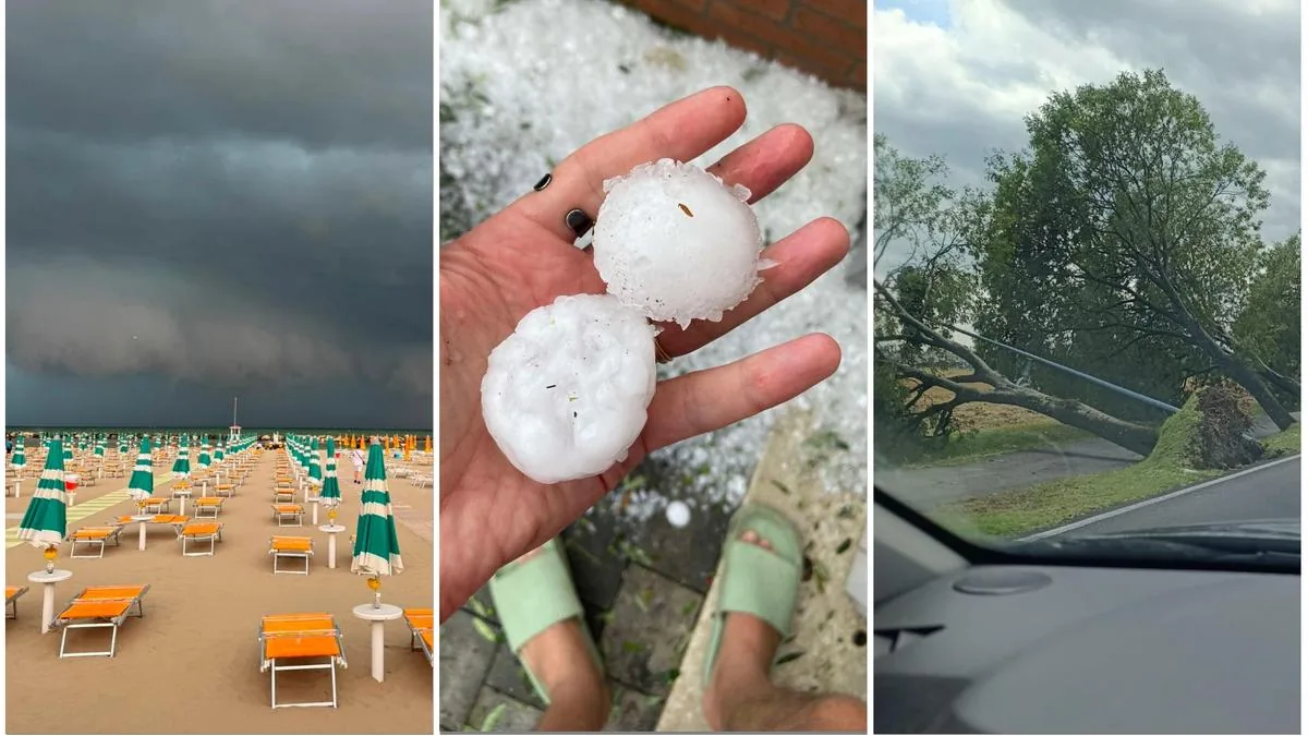
Bologna, July 21, 2026 – More cloudbursts and hailstorms after the record phenomena of recent days. This time they will be brief but intense and will extend throughout the region, from the Apennines to the sea. The strong thunderstorms arrived in the Ferrara and Rimini areas already late this morning, where they have already started to cause the first damage. Large hail, wind, and flooding.
The bad weather will then continue in the afternoon and during the evening.
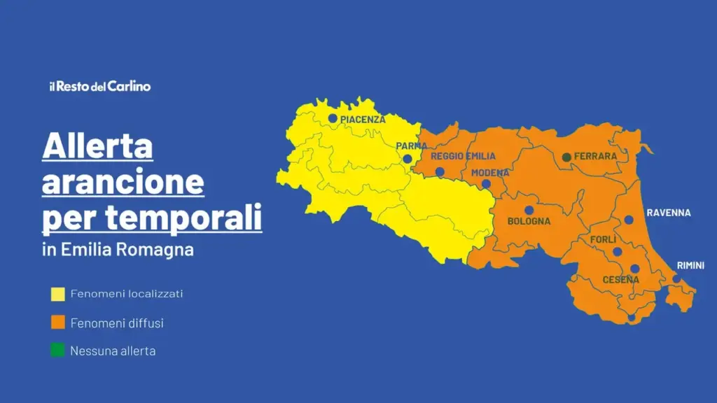
Orange thunderstorm alert
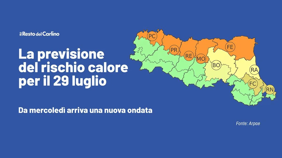
Arpae and the Civil Protection of Emilia Romagna have modified the weather alert for thunderstorms they had issued yesterday for today, Tuesday, July 21, changing it from yellow to orange (from 12:00 on July 21) for the provinces of Parma, Reggio Emilia, Modena, Bologna, Ferrara, Ravenna, Forlì-Cesena, and Rimini. A yellow alert is also reported for landslides and floods of minor watercourses in the provinces of Bologna, Ravenna, Forlì-Cesena, and Rimini, and for thunderstorms in the provinces of Piacenza, Parma, and Reggio Emilia.
“Strong thunderstorms from the Apennines to the plain”
“For today, Tuesday, July 21, strong thunderstorms are expected to form from the Apennine sectors with extension to the plain areas with probable associated effects and damage – states the bulletin –, probably of greater significance and intensity in the central-eastern sector of the region. Along the entire hilly and mountainous belt, especially the central-eastern one, localized runoff phenomena and landslides on particularly fragile slopes will be possible in the afternoon. In the areas affected by the phenomena, rapid increases in hydrometric levels in the hydrographic network and flooding in inhabited centers are possible. For tomorrow, Wednesday, July 22, no significant phenomena are expected for alert purposes. However, residual thunderstorms in the early hours of the day and strong ventilation (50-61 km/h) from the northeast on the coastal sector during the morning are not excluded.”
Risk of large hail
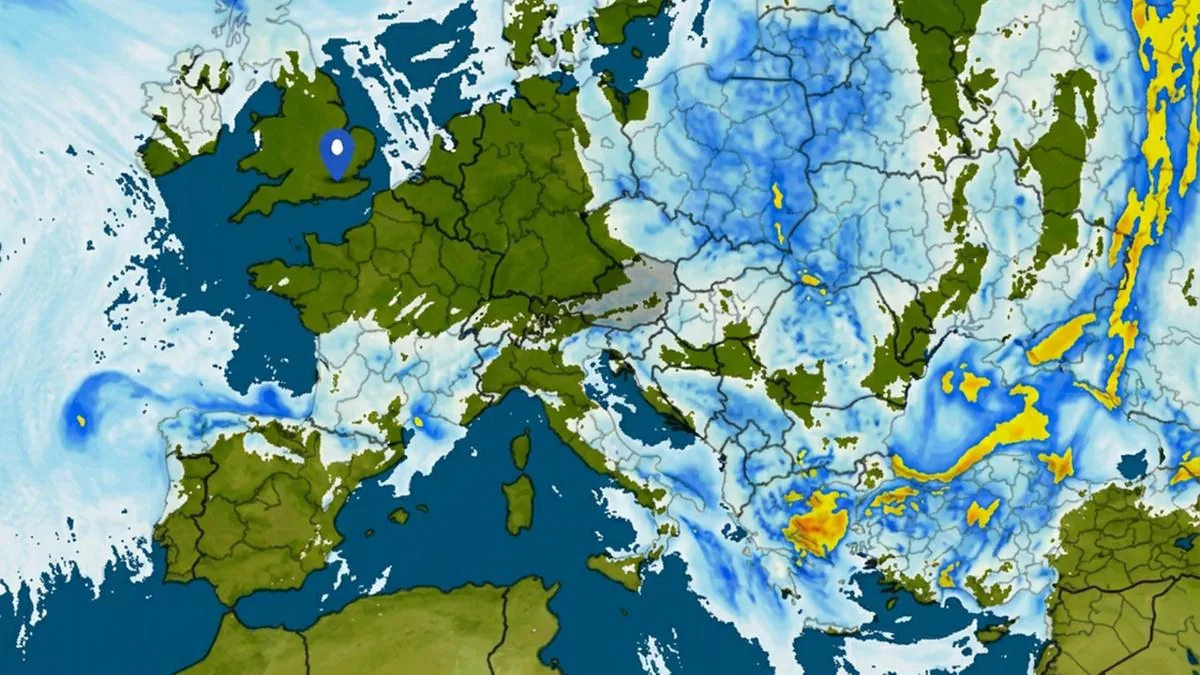
“The first thunderstorms should form on the reliefs between the Bologna area and Romagna – writes Emilia Romagna Meteo – , then between the Ravenna and Forlì areas, affecting plains and hilly areas up to part of the Riviera. Shortly after, thunderstorms also from the Parma reliefs towards those of Reggio Emilia, Modena, and Bologna. In the evening, after 9 PM, new thunderstorms will form on the plains of Emilia, moving towards the reliefs between Reggio Emilia and Bologna and over Romagna.” There is a risk of large hail “and strong gusts of wind. Hail could fall anywhere.”
Live news
Bad weather has arrived on the Romagna coast, with several lifeguard towers reported knocked down on Cesenatico beach.
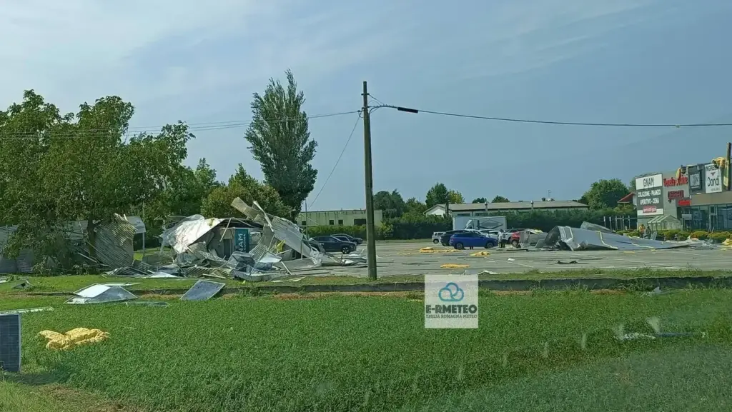
“Heavy damage also to some structures in Vigarano Mainarda (Ferrara) – reports Emilia Romagna Meteo -: the Dondi furniture factory is partially unroofed with sheet metal ending up on parked cars, many uprooted trees. The state road to Cento is interrupted in Vigarano Mainarda due to fallen high-voltage cables on the road, several road signs knocked down and some chimneys fallen.
Due to damage caused by bad weather (presence of branches on the line in Poggio Renatico), High-Speed and Regional trains on the Bologna-Venice line experienced increased travel times of up to 70 minutes. Traffic returned to normal at 2:15 PM.
Furthermore, as reported by Trenitalia Tper, due to other damage caused by bad weather on the Ferrara – Ravenna line, several trains have been cancelled.
First the heat, then the hailstorms and cloudbursts with damage in the fields of Romagna, especially in the northern part of the province of Ravenna. In view of today’s new weather alert, Legacoop Romagna is monitoring the situation in the main cooperatives of the area, such as Terremerse, Terre Cevico, Apofruit Italia, and the Agricultural Labor Cooperatives of the province of Ravenna. And the provisional balance, it says, “is dramatic“: both field productions and storage and processing structures have been affected. The very high temperatures had already caused the breakdown of strategic equipment and machinery “with significant economic damage, both for repair costs and for emergency interventions implemented to ensure product refrigeration,” it highlights.
And prolonged thermal stress has already caused “an estimated 10% reduction in the caliber of some of the main summer fruit varieties.” Faced with this, there is also the “paradox” of insurance companies, because the value of crops destroyed by hailstorms “is revised downwards due to the impact of excessive heat in previous weeks. A position that risks leaving member producers without adequate compensation in the face of the climatic catastrophe,” remarks the Romagna cooperative center. The president of Apofruit Italia, Mirco Zanotti, reports “considerable damage” because torrential rains brought water into the Lavezzola and Altedo plants. Meanwhile, hail has “severely damaged the roofs and coverings of the San Martino in Spino warehouse, in the Modena area.”
As for member producers, even in the absence of definitive data, “heavy repercussions are estimated in the territories between Northern Emilia and Triveneto (particularly in the provinces of Bologna, Rovigo, and Verona), with significant damage suffered by valuable crops such as kiwi, apples, and pears.” In Terremerse, president Marco Casalini sees the heaviest damage on industrial tomatoes, with affected members ranging from Verona to the province of Ferrara up to the northern part of the Ravenna area.
The passage of the violent thunderstorm that descended from the lower Modena, Ferrara, and northern Ravenna areas, grazing the Rimini area – explains Emilia Romagna Meteo – has “consumed” a lot of energy over many areas not directly affected. This could be a positive factor for the coming hours: the thunderstorms expected in the afternoon might have less energy available, and therefore would have more difficulty in triggering. However, the possibility of strong local thunderstorms remains, more likely from late afternoon.
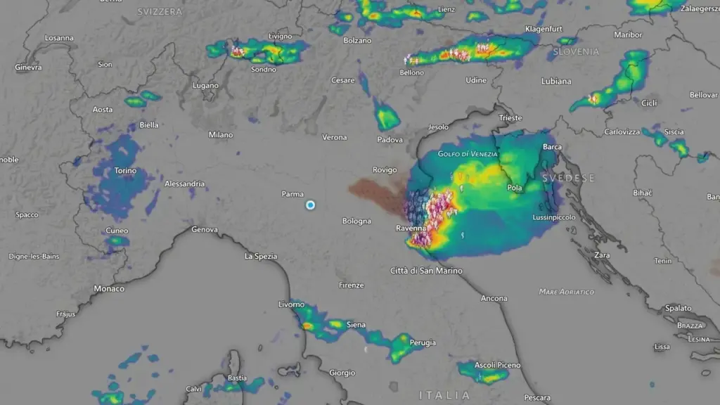
The first thunderstorms and hailstorms that have already started causing damage (trees fallen on the road in Vigarano Mainarda, in the Ferrara area) arrived late this morning in the Ferrara area in San Martino di Ferrara, Bondeno, and Vigarano Mainarda, on the Rimini and Ravenna coasts, in the Lower Modena area (between Mirandola, San Felice sul Panaro, Finale Emilia).
The consequences of the thunderstorms will be a sharp drop in temperatures with highs between 27 and 30 degrees. “The trend – explains Roberto Nanni, Ampro meteorologist – will continue for a few days, after which, as we approach the weekend, the heat will make itself felt again with an African wave, although not at the levels we have had to endure until today. The scenario that awaits us in fact foresees a convergence with currents arriving from Northern Europe and which will therefore generate greater instability“.
Read more Sit-in for Fakir, Bignami against the mayor: «He is irresponsible, now he must resign»